Public PSPS Situation Viewer
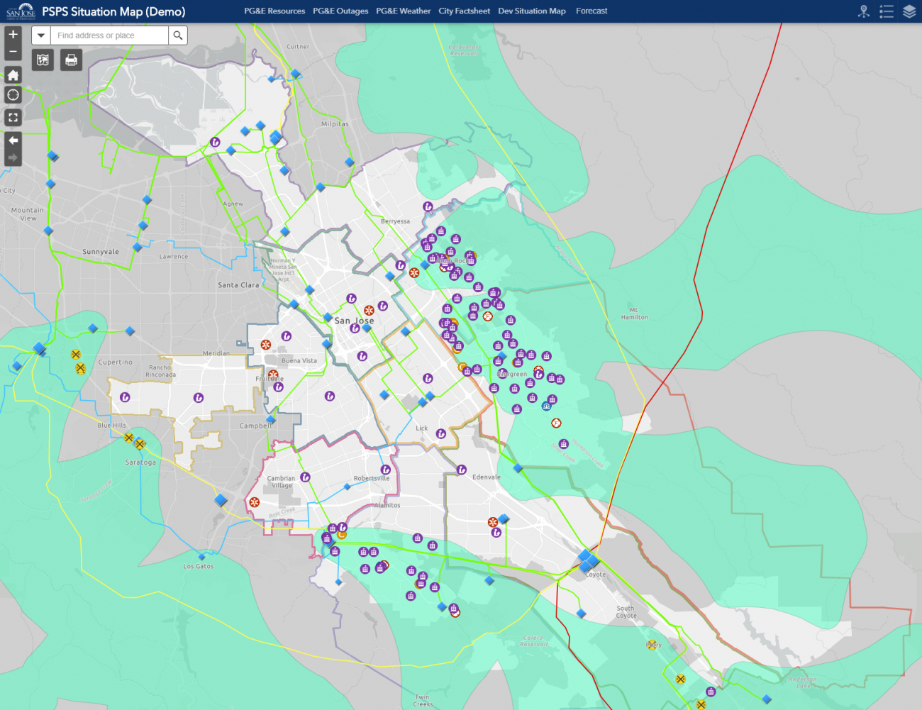
This map is meant to assist first responders in San Jose to reach out to residents in need during power outages in wildfire season, and allow residents to communicate with city officials about which areas in the city have power.
Stats
Dataset(s): Datasets from San Jose’s Spatial Data Repository, data feeds from several San Jose data systems, Internal customer information from PG&E, data collected from San Jose residents during power outages via online surveys
Visualization: Map
Jurisdiction: City of San Jose
Developed by: San Jose Department of Public Works
Map Monday: Emergency Management in San Jose
February 24, 2020 Data Visualization Map Monday Map: Public PSPS Situation Viewer Geographic Area: San Jose, CA Year Published: 2019 Goal: To both assist first responders in San Jose to reach out to residents in need during power outages in wildfire...

