3D Model of New York City
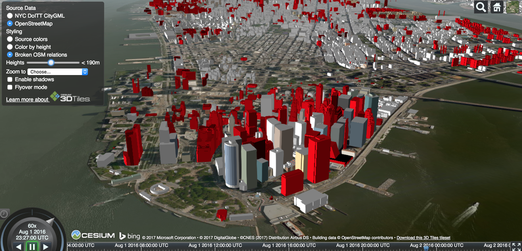
CESIUM's data visualization brings together features discussed in other entries-like mapping city-wide shadows and historical development-in one 3D model of New York City. This data visualization uses 3D Tiles to represent location data in a responsive manner leading the way to fulfilling the Digital Earth vision. Users can search by neighborhood and building height, and start/stop clock allows users to view change over time.
