- August 6, 2019
- Infrastructure
This post originally appeared on Stephen Goldsmith's Better, Faster, Cheaper blog on Governing.com
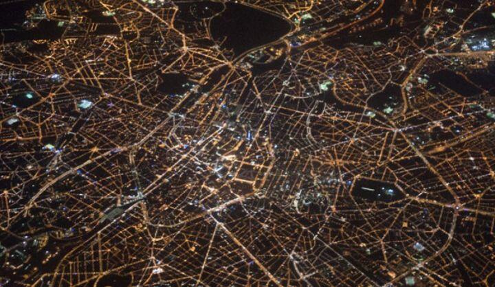
There's a lot of enthusiasm among city planners these days about "digital twins," computer-based replicas of physical assets (in this case, entire cities) that reflect the moment-to-moment condition of the built environment as well as the people, vehicles and other items that move through it. At its heart, a digital twin is a map, but where traditional maps are static and limited in their scope, digital twins add a dynamic quality that produces many more insights.
Any city official who has attended a contested zoning hearing knows well the political heat that surrounds traffic studies associated with proposed projects: Residents often don't trust them, they are expensive, and their findings can be inaccessible to non-experts. However, with a digital twin, planners and the public can look at a digital representation of street conditions surrounding a proposed development at any time interval, whether Monday-morning rush hour or the dead of night. On the fly, officials can add and subtract proposed amenities in an effort to make their case or find an appropriate compromise with skeptics.
Despite the relative obscurity of the term "digital twin" outside of the realm of experts, public leaders have an obligation to understand the application and opportunities associated with its implementation. The degree of urgency correlates with the immense potential of this evolving technology; soon, elected officials and administrators will be more frequently testing their ideas on a digital-twin city before committing them to concrete.
A digital twin, for example, might help city planners identify commuting challenges. Producing current-state and modeled changes on a digital twin could enable officials and advocates to push through new transportation options or update urban land-use plans so that important amenities would be closer to where they are most needed.
From a predictive standpoint, a city might use its digital twin to accurately predict the effect that a new bike lane or other piece of infrastructure would have on traffic congestion or safety. Similarly, planners could use the twin to anticipate road-closure effects, predict changes in air quality or measure how much green space would be needed to accommodate various amounts of rainwater.
In addition to addressing land use, transportation and environmental issues, twinning can support permitting, crisis management, infrastructure development and more. A city could envision different disaster scenarios and contemplate how emergency relief should respond. Even economic development would not be beyond the scope of a digital twin. A digital twin, for example, could help a city predict where to locate a new job-training resource based on how many people in a specific set of neighborhoods might use that resource. The possibilities are endless.
Digital twins require a wide array of data sources. Many new buildings now come with comprehensive, matching digital models that will need to be input. Feeds from transportation agencies and companies might also help inform cities in real time about road conditions. The data dashboards that cities are already developing will no doubt offer a crucial leg up in developing digital twins.
But while smartphone-aggregated and anonymized data can provide important information, it also raises concerns about protecting privacy. As The New York Times has reported, at least 75 companies receive location data from apps, which update peoples' whereabouts as much as 14,000 times a day. As jarring as that level of information surveillance may be, the idea of digital-twin mapping -- combined with various methods for anonymization, encryption and other forms of data protection -- represents an opportunity for much good to be done with that abundance of data.
A number of digital-twin projects are well underway. Portland, Ore., for example, is launching a one-year pilot to develop a digital twin using technology from a Sidewalk Labs initiative called Replica. Pasadena, Calif., has begun to require new development projects to submit 3D digital models of their buildings at the time of a permit filing, a process that will be integral to the development of comprehensive digital twins. In India, the state of Andhra Pradesh has committed to build a $6.5 billion city from the ground up with a level of cartographical detail that would effectively make it the first city born with the aid of a digital twin.
In the future, it may be inconceivable to think of a time when a digital twin wasn't an absolute necessity for the proper functioning and growth of a city. For instance, the impending proliferation of autonomous vehicles will require a highly accurate, networked image of the city for driverless cars to reference one another as well as to stay abreast of changing road and pedestrian conditions.
While the privacy risks remain, so do the potential rewards. Digital twins offer the opportunity for us to make our worst mistakes in the cloud and implement only our best ideas on the ground.
 Stephen Goldsmith is the Derek Bok Professor of the Practice of Urban Policy at the Harvard Kennedy School and the