

Murder with Impunity
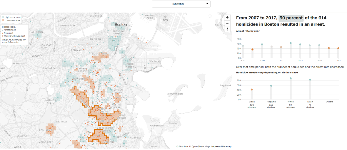
The Washington Post’s ‘Murder with Impunity’ map and database highlight urban areas “where murder is common but arrests are rare.” The Post’s visualization of this new collection of cities’ data can help policymakers and members of the public see their city and community in new ways. Previously uncovered trends, hotspots, or overlooked gaps in public safety can lead to increased action by law enforcement and government, and increased safety and trust for residents.
Stats
Dataset(s): Analysis of more than 52,000 criminal homicides and subsequent arrests in 55 US cities
Visualization: Map
Jurisdiction: United States
Developed by: The Washington Post
Map Monday: Unsolved Homicides
June 25, 2018 Data Visualization Map: Unsolved Homicides Geographic Area: 50 of the largest U.S. cities Year Published: 2018 Goal: To reveal areas where criminal homicides remain unsolved by creating a street-level visualization of arrest and homicide...

