

Mapping Immigrant America
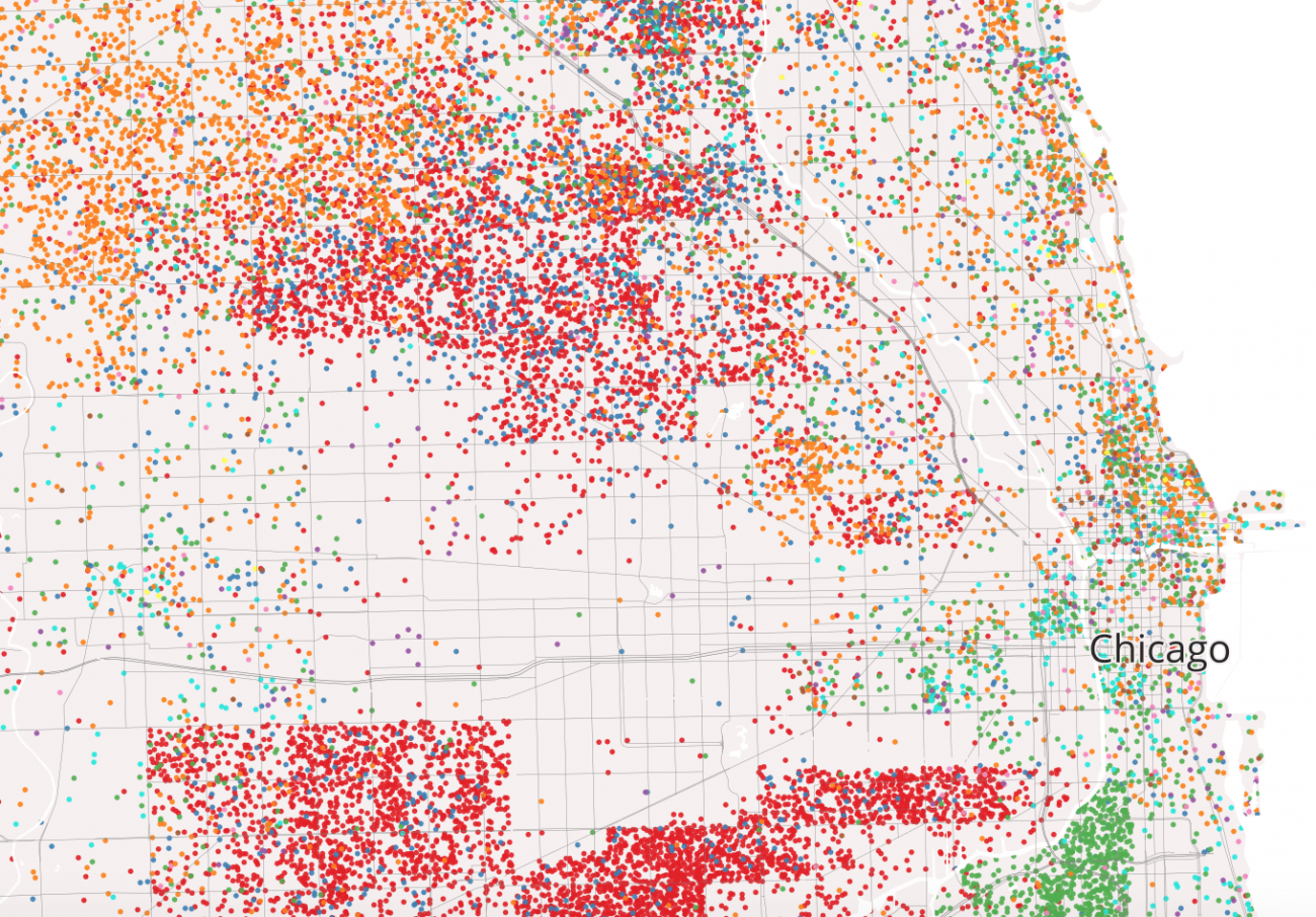
These types of cultural enclaves are sprinkled across America, and brimming with immigrants who add significant economic and cultural value to their cities. Using census tract data, the map represents the concentration of America's immigrant population as dots, colored according to their country of origin (shown in key at left). What results is a unique mix of colors-an immigrant fingerprint of each city, showing where its immigrant residents are from and where they currently live.
