Jefferson County Coronavirus Response
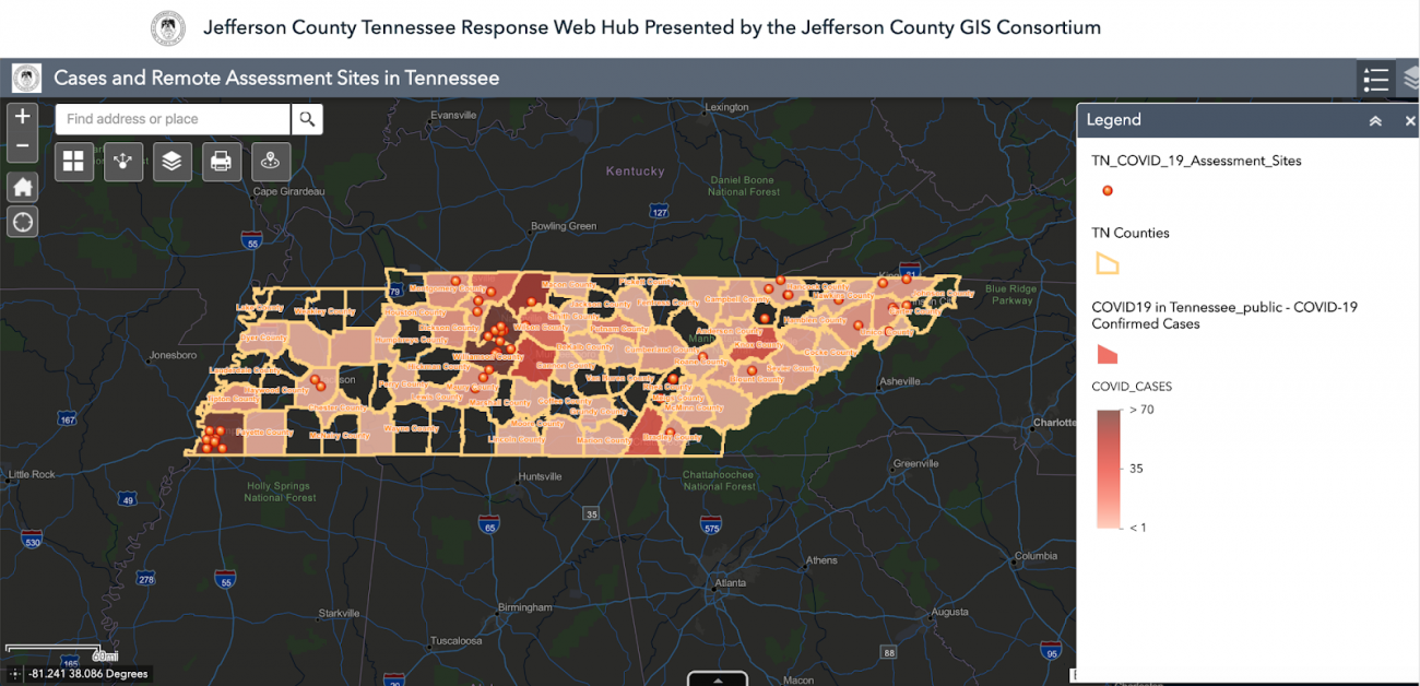
This dashboard focuses on response measures and healthcare access. Several maps display available hospital beds, where providers are located based on care needs, and where there are travel advisories. One visualization directs residents to the nearest coronavirus “assessment site” where they can be evaluated and potentially tested for the virus. This map is overlaid with data showing where there are confirmed COVID-19 cases throughout the state and is updated daily.
Stats
Dataset(s): Jefferson County Health Department
Visualization: Dashboard
Jurisdiction: Jefferson County
Developed by: Jefferson County
COVID-19 Response: GIS Best Practices in Local Government
March 31, 2020 Data Visualization The coronavirus has officially put a stranglehold on America. City life as we know it has been brought to a grinding halt, particularly in some of the country’s most vibrant metros such as New York City. As we all await...

